Location and Geography
|
Vertical Divider
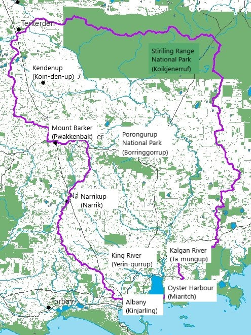
The Oyster Harbour Catchment is situated along the South Coast of Western Australia and is a part of the South West Botanical Region. It stretches from Albany (Kinjarling) through to Tenterden, across the Stirling Ranges (Koikjenerruf) to Chillinup and South to, but not including, Two People Bay (Yelbering). The entire area is approximately 3000 square kilometres and includes populated centres of the City of Albany and the township of Mt Barker (Pwakkenbak), Porongurup (Borringgorrup) and Kendenup (Koin-den-up). There are a total of 48 sub-catchments contained within the Oyster Harbour Catchment.
The Oyster Harbour (Miaritch) is the centre catchment of the Albany Hinterland and shares its common borders with the Wilson Inlet Catchment to the West and Albany Eastern Hinterland to the East. These catchments fall into the South Coast Natural Resource Management Inc. area of responsibility that includes the South Coast, from Walpole in the West to Esperance in the East. |
The Catchments:
History
Climate
Natural Resources
Natural Assets
The catchment contains many natural assets such as the Oyster Harbour, the Kalgan River, the King River, the Porongurup National Park and the Stirling Range National Park. In total, there are approximately 31 Nature Reserves and 38 listed Heritage Sites within the catchment. see more
Threatening Processes
Also see DAFWA: Rapid Catchment Appraisals. Local Noongar Place Names
Our Groups:
Groups history
Committee
Staff
Funding
Partners in Land-care
Tourism
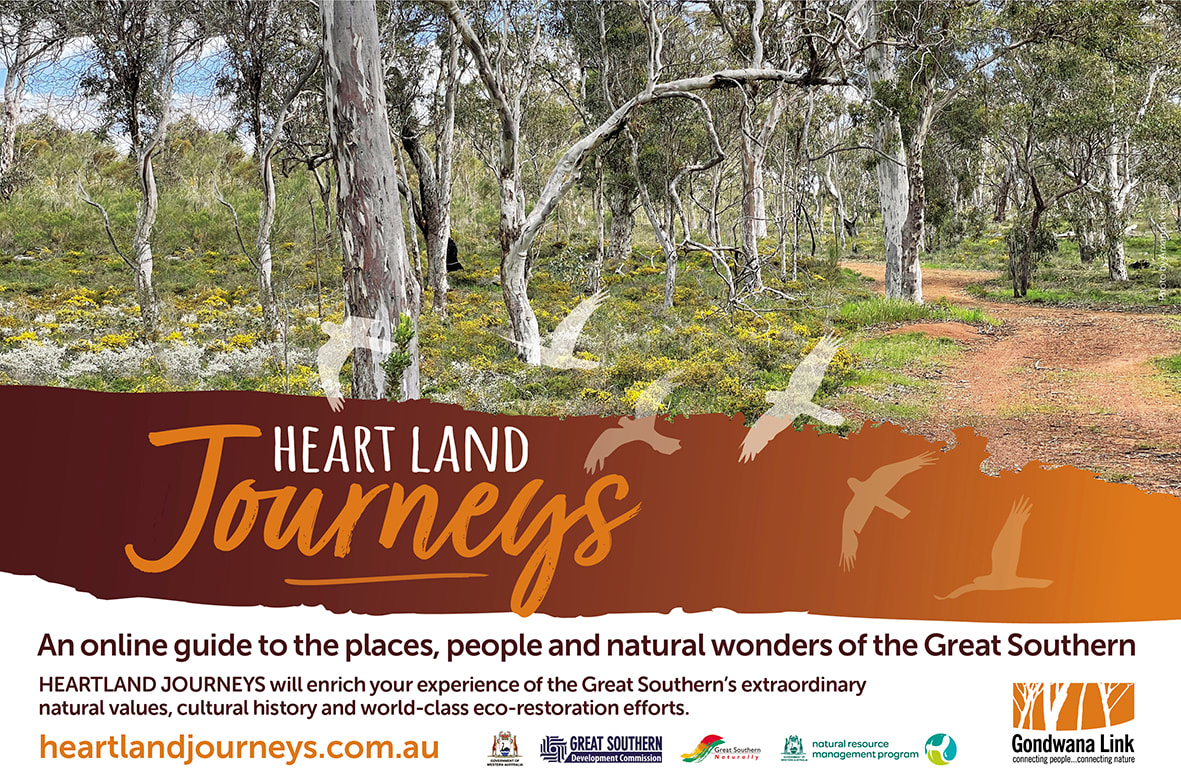
If you want to learn more while journeying through our catchment please tread lightly. We highly recommend following one of the Heartland Journey drives to learn more about place and listening to locals telling their story.
Heartland Journeys is an exciting new online guide to the places, people and nature of the Great Southern: www.heartlandjourneys.com.au. Aiming to take visitors beyond the scenic and recreational values of the Great Southern and provide deep dives into this biological wonderland, while also showcasing community efforts to restore ecosystems and farmland to health. HEARTLAND JOURNEYS is intended for visitors and locals who have these interests.
It features audio and video stories from Heather A, Peter L, Tim Saggers, Lucia and others. There are quite a number of places listed in the Oyster Harbour catchment and Ranges Link with more to come. Our ‘Nature insights’ segment includes ‘What is a biodiversity hotspot’, ‘Remarkable plants’, ‘Kwongan’, ‘Honey possum’, Invertebrates’, ‘Life on granite’, and more of these ‘fact sheets’ are being
Produced by Gondwana Link, this guide is for visitors and locals wanting to learn more about the natural wonders and cultural richness of the Great Southern, as well as the globally significant landcare and eco-restoration programs underway.
Heartland Journeys brings together an interactive map, self-drive journeys, biodiversity information, and a trove of multi-media stories, including a podcast for on-the-road listening. Hear from Noongar Elders, Landcare's and people passionate about the natural values of this region.
All this information will help visitors take a deep dive into this biological wonderland and hear directly from the people who know it best.
They're adding more Great Southern stories, information, places and journeys. Please contact Marg Robertson if you have any feedback or suggestions: [email protected]
We acknowledge the Minang and Koreng people as the traditional custodians of the land on which we work and live. We pay our respects to the Elders, past, present, and emerging and to the wider Noongar community.
Sponsors and Supporters

