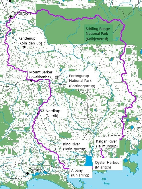
The catchment contains many natural wonders/assets such as
These all contribute to the catchment high biodiversity (which is a natural wonder in itself) and the catchments overall ecological health/productivity.
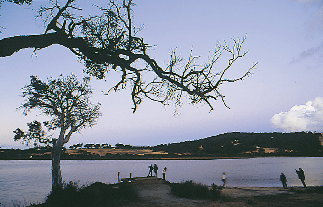
- Oyster Harbour (Miaritch)
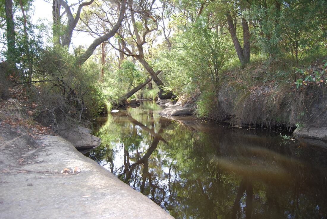
- Kalgan River
- King River
- Yakamia creek
- Porongurup National Park (Borringgorrup)
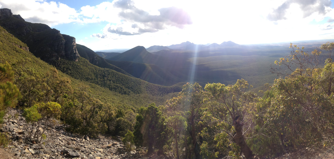
- Stirling Range National Park (Koikjenemuf)
- Numerous Nature Reserves and Heritage Sites
- Numerous lakes and wetlands
These all contribute to the catchment high biodiversity (which is a natural wonder in itself) and the catchments overall ecological health/productivity.
| EPBC Act Protected Matters Report | |
| File Size: | 175 kb |
| File Type: | |
Our High Biodiversity
The catchment is located within the Southwest Australia Ecoregion, an internationally recognised biodiversity hotspot (Conservation International, 2017). This was the first biodiversity hotspot identified in Australia, with 15 currently registered (Lambers, 2016; Hales, 2014).
Learn more about Biodiversity Hotspots here
See more about our:
Learn more about Biodiversity Hotspots here
See more about our:
Bush land and Reserves
| albany_coast_parks_and_reserves_management_plan.pdf | |
| File Size: | 7446 kb |
| File Type: | |
Our National Parks
| stirling-porongorup_nps.pdf | |
| File Size: | 1588 kb |
| File Type: | |
The Stirling Ranges (Koikjenemuf)
The Porongurup National Park (Borringgorrup)
Porongurup Bioblitz Wetlands Survey: Nunarrup Lagoon and Kaimerndyip Lake (2018).
Porongurup-Bioblitz-Wetlands-Survey-2018-reduced.pdf (23 downloads) prepared for Green Skills Inc., Denmark WA. Reduced size version for download.
See Friend of the Porongurup Range website for local perspective
Porongurup-Bioblitz-Wetlands-Survey-2018-reduced.pdf (23 downloads) prepared for Green Skills Inc., Denmark WA. Reduced size version for download.
See Friend of the Porongurup Range website for local perspective
Our Main Waterways
Survey of River Foreshores in the Oyster Harbour Catchment 1997 by APACE Green Skills and Dr Luke Pen, Water and Rivers Commission.
The Kalgan River
The King River
The Oyster Harbour (Miaritch)
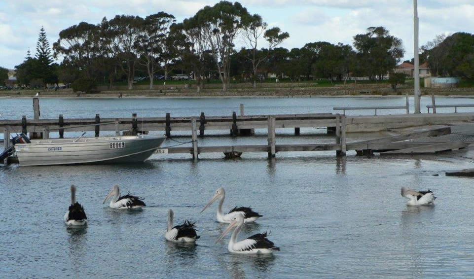
The picturesque Oyster Harbour is highly valued for its role in tourism, commercial and recreational fishing and oyster and mussel farming. Fish traps built near the mouth of the Kalgan River in Oyster Harbour approximately 7000 years ago remain sacred to the Menang people.
The ecosystem collapsed in the 1990s with significant seagrass loss. It has been recovering since, but there is need to boost the active management of waterways and increase actions to improve water quality in the region.
See more
The ecosystem collapsed in the 1990s with significant seagrass loss. It has been recovering since, but there is need to boost the active management of waterways and increase actions to improve water quality in the region.
See more
Other Waterways
Willyung Creek
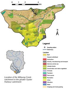
Willyung Creek has a catchment area of about 35 km² which has been almost entirely cleared. The dominant land use is cropping and mixed grazing which covers nearly half of the catchment. The western edge of the suburbs of Albany fall in the southern portion of the catchment along with a large number of lifestyle blocks. In the agricultural areas, waterways mostly retain their natural form whereas they have been converted to drains in the urban areas. Fringing vegetation is missing or poor in most of the catchment. Most of the catchment has soils with a high phosphorus binding capacity, though there are areas of soils near the creek with a low phosphorus-binding capacity. In these areas, any phosphorus applied to the soils can be quickly washed into drains and other waterways.
See nutrient report: willyung_creek_2019
See nutrient report: willyung_creek_2019
Mill Brook
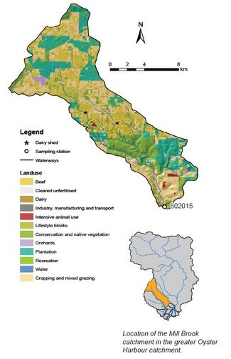
Mill Brook has a catchment area of about 180 km², 90 per cent of which has been cleared, mainly for cropping and mixed grazing, beef cattle and bluegum plantations. There are also two dairy sheds present and a large area of remnant vegetation in the Mill Brook Nature Reserve which is in the lower half of the catchment. While the waterways remain in a mostly natural state, much of the fringing vegetation has been lost or is in poor condition.
Along Mill Brook, the soils tend to have a low phosphorus-binding capacity. This means that any phosphorus applied to them can be quickly washed into waterways. The rest of the catchment has soils which tend to bind phosphorus reasonably well.
References and further reading:
Speldewinde PC, Close P, Weybury M and Comer S 2012 Habitat preference of the Australian water rat (Hydromys chrysogaster) in a coastal wetland and stream, Two Peoples Bay, South West Western Australia, Journal of the Australian Mammal Society 35(2)
Hosie A 2013 ‘Why freshwater crayfish don’t need milk for healthy bones ‘ Western Australian Museum, https://museum.wa.gov.au/explore/blogs/andrew-hosie/why-freshwater-crayfish-don-t-need-milk-healthy-bones https://museum.wa.gov.au/explore/blogs/andrew-hosie/why-freshwater-crayfish-don-t-need-milk-healthy-bonesaspx, last updated October 2020
See nutrient report Mill Brook 2019
Yakamia Creek
Catchment nutrient report Yakamia Creek 2018 (PDF, 5.17MB)
Yakamia Creek Living Stream Management Plan. “A Living Stream Management Plan starts with a degraded and fragmented urban waterway and considers ways to introduce ecosystem attributes that are compatible with the multiple constraints that urbanization has created.” by Steve and Geraldine Janicke
A reduced quality version has been provided here, divided into three parts.
- YAKAMIA_CK_LSMP_PartA_without_maps.pdf (268 downloads) (1.3 MB) includes the headings: Introduction, The characteristics of Yakamia Creek and Yakamia Creek as a Living Stream.
- YAKAMIA_CK_LSMP_PartB_without_maps.pdf (264 downloads) (2 MB) includes the headings: Yakamia Creek Living Stream opportunities – the assessment methodology and the Tables: Table 6: Tier 1 Summary of opportunities, objectives and design considerations, Table 7: Recommendations to OHCG for Tier 1 sections, Table 8: Tier 2 Summary of opportunities, objectives and design considerations and Summary of General recommendations to OHCG for Tier 2 sections downstream of North Road.
- YAKAMIA_CK_LSMP_PartC_Appendices.pdf (196 downloads) (1.7 MB) includes the appendices: APPENDIX 1: Constraints scoring for each section of Yakamia Creek, APPENDIX 2: Section Maps and APPENDIX 3: Use of Unmanned Aerial vehicles.
Kendenup Lakes Ecological Investigation Report (2017)
KENDENUP-Lakes-Ecological-Investigation-2017-reduced.pdf (28 downloads) prepared for Green Skills Inc., Denmark WA. Reduced size version for download.
KENDENUP-Lakes-Ecological-Investigation-2017-reduced.pdf (28 downloads) prepared for Green Skills Inc., Denmark WA. Reduced size version for download.
We acknowledge the Minang and Koreng people as the traditional custodians of the land on which we work and live. We pay our respects to the Elders, past, present, and emerging and to the wider Noongar community.
Sponsors and Supporters

