Vegetation Surveys and Weed Control in
the Ranges Link
The Ranges Link is a community driven project aiming to identify, protect and enhance wildlife corridors between the Stirling Range National Park and the Porongurup Range National Park, in the great southern of WA. High biodiversity value native vegetation currently exists along waterways and in remnants on private properties, predominately on broadacre farms. Many of these areas are under threat from livestock grazing, wind and water erosion, salinity and eutrophication. The biodiversity of the plants and animals in some areas are under threat due to isolation. These corridors and linkages will address the problem of plant and animal communities being isolated, and provide a safe passage for native birds and animals moving north/south between the national parks.
The group uses its extensive local knowledge and experience to target individual areas at risk and work with the individual landholders to plan on-ground works.
The Ranges Link Project works closely with Gondwana Link, an ambitious program that aims to secure, through conservation and restoration, a 1,000km band of healthy native habitat across south west Western Australia (WA). This effort involves a number of organisations working collaboratively, including Bush Heritage Australia (BHA), Friends of the Fitzgerald River National Park, Fitzgerald Biosphere Group, Greening Australia (GA), Green Skills, The Nature Conservancy (TNC) and The Wilderness Society (TWS).
The Ranges Link group is made up of 4 local landholders all committed volunteers with many years of landcare/NRM experience. They work closely with other lifestyle block occupants and broadacre farmers in the area to raise awareness of environmental conservation as all on ground works are on private property. The aim is to protect and enhance areas of native vegetation to form a corridor between the Stirling Range and Porongurup Range National Parks in the great southern of WA. They meet bimonthly to manage existing projects and plan future activities.
All on-ground works are carried out by contractors employed by the group. In this way fencing, revegetation work, weed and pest control can be carried out in a well coordinated way quickly and efficiently, using best practise. When sufficient funds are available, the group fully funds the construction of the fences which means that specific areas can be targeted for attention without having to consider the capacity of the landholders to do the work.
This project has received strong support from Mt Barker Chicken and Waratah since 2009 in addition to a range of Federal and State Government funding sources to assist with achieving its aims.
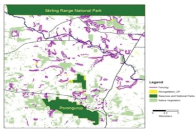
With the overall aim of reconnecting the PorongrupPorongurup and Stirling Range National Parks, planning for the Ranges Link project has included mapping all of the remnant vegetation and identifying potential routes for connectivity. Also included has been identifying Remnants with vulnerable species of flora and fauna, as well as underrepresented vegetation communities, as key areas for protection.
A Conservation Action Plan (CAP) has been developed by the group identifying eight key ecological targets as the focus for protection and restoration efforts.
Ranges Link - Planning
The aim is to improve the viability of each of these targets, which should improve the ecological condition of the entire system. Each target includes "nested" targets (species or communities with similar needs, threats or situation) and has different characteristics or attributes that need to be considered when developing strategies for their protection. See Conservation Action Plan in resources.
The key conservation targets with "nested" targets
Wandoo Woodland Ecosystem
- Black cockatoos, Brush-tailed possum, Mistletoe Bird, Rufous tree Creeper
- Invertebrates (e.g. worms, slaters, spiders, etc.); Purple-crowned lorikeet; Rufous tree Creeper; Porongurps Karri System; Python; Yate; (Eucalyptus occidentalis) swamps
- Upland Eucalyptus cornuta (yate)
- Honey possum; Honey eaters
- Malleefowl; Kamballup Dryandra; Proteaceous species; Myrtaceous species; Epacridaceous species
- Blue Wrens & other small bird species; Emphemeral plant species
- Black Cockatoos; Brush tail possum; Echidna
- Black Gloved Wallaby
- Black Cockatoos
- Red tailed black; Baudin’s white-tailed black & Carnaby’s white-tailed black cockatoo
|
Stirling Range National Park
|
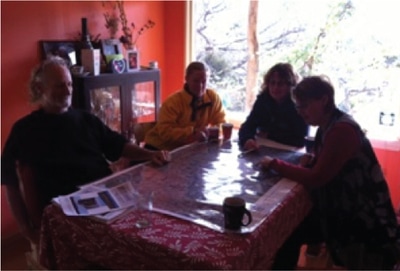
Planning session for the “Rangers Linkers” - Peter Luscombe, Lucia Quearry, Heather Adams and Judy Hunt.
|
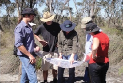
Planning session out in the field
|
We acknowledge the Minang and Koreng people as the traditional custodians of the land on which we work and live. We pay our respects to the Elders, past, present, and emerging and to the wider Noongar community.
Sponsors and Supporters

